iSweep and geotagging
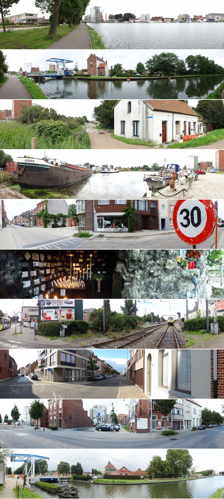
Digital apparel continues to develop apace. The pixel war continues with, for instance, compact cameras now moving significantly beyond 10 mp with new sensor technologies. And then there is a steady stream of more or less gimmicky add-ons. I am not keeping track of all these developments. However in the framework of my Matterhorn-project I have been interested by the possibility to geotag pictures, i.e. to add GPS-derived co-ordinates to images. Now this features is also becoming available in cheaper compact cameras. I capitulated for the 10.2 Mp Sony Cybershot DSC-HX5V when I noticed that it also offers the iSweep intelligent panorama function. It's crazy: you just move your arm with the camera in an 180° arc and the thing combines 100 exposures in a single 7152 x 1080 image (with Horizon-like distortion). As is obvious from on the pictures above, the stitching is not always perfect. It does take a little practice. But 90% of the panos without moving objects are perfect. Apparently the images are captured from the video feed, so it is not suitable for real, publication quality stuff. But for purely documentary purposes it's excellent. From October onwards I will start to work on an urban design studio in the framework of my Master of Human Settlements studies. The studio centers on Turnhout. One of the things I would like to do to jumpstart the studio work is to collect a database of pictures of the city and its surroundings. I think these very wide angle panoramas work very well to remind planners of the surroundings. This in combination with the geotagging functionality is awesome. Each image can be inserted into Google Maps or Google Earth or any other GIS mapping software. Anyway, that's the idea. Yesterday I went to Turnhout, made a short walk north of the city along the canal and captured around 50 panorama images. All of those have geodata as part of the exif-file. However, I have not been able to insert the pics in Google Maps yet (tried a few routes, via iPhoto on my Mac, Flickr and Panoramio, but no success so far). However, I am quite sure it can be done. This will also be very useful to document the Matterhorn project.
posted by Philippe at
3:27 PM
![]()


0 Comments:
Post a Comment
<< Home